1 KIMBALL LN
Owner Information
CRONIN, FRAN A.
1 KIMBALL LN.
CAMBRIDGE, MA 02140-1810


Property Details
1 KIMBALL LN is classified as a Single Family Residential (Conventional).
The primary structure on this property was built in 1900. There are 3715ft2 of built area within this property. There is 1960ft2 of residential/living space within this property. This property is listed as having 7 rooms.
1 KIMBALL LN is valued at 1174100. The land is valued at 536800 and the structures are valued at 637300.
This property is in Zone B. Confirm with local Zoning Board authorities to ensure there are no overlays or other easements on this property.
The most recent deed for 1 KIMBALL LN is recorded at the local registrar in Book 31073, Page 0197. 1 KIMBALL LN was last sold on 2000-01-21 for 605000.
Assessment data from fiscal year 2021.
Flood Data
According to the FEMA National Flood Hazard Layer, this property does not appear to be in a flood zone. It may also be in an area not yet reviewed. Nonetheless, confirm this information prior to taking any action.
To view the flood hazards around this property, create a FEMA "Firmette" Map of the area around 1 KIMBALL LN.
Broadband Internet Providers
| Provider | Type | Bandwidth (mbps) | |
|---|---|---|---|
| Verizon New England Inc. | DSL | 7 | 0 |
| VSAT Systems, LLC. | Satellite | 2 | 1 |
| HughesNet | Satellite | 25 | 3 |
| GCI Communication Corp. | Satellite | 0 | 0 |
| netBlazr Inc | Fixed Wireless | 50 | 50 |
| Starry, Inc. | Fixed Wireless | 200 | 200 |
| Comcast | Cable | 1000 | 35 |
| Viasat Inc | Satellite | 100 | 3 |
Broadband service provider data from December 2020.
Adjacent Properties
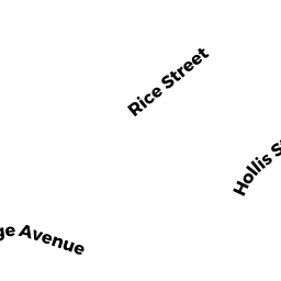
- 36A RICE ST #36/A3
Residential Condominium owned by CARTER, MATTHEW - 36A RICE ST #36/A1
Residential Condominium owned by PHILLIPS, NANCY E. - 36A RICE ST #36/A2
Residential Condominium owned by HEALY, DOUGLAS & STEPHANIE GROLL - 36 RICE ST
CONDO-BLDG owned by CARTER, MATTHEW - 50 RICE ST
Single Family Residential owned by BOEHMER, CLIFFORD J. & - 19 HOLLIS ST
Two-Family Residential owned by WATERFIELD HOLLIS LLC. - 17 HOLLIS ST
CONDO-BLDG owned by KUHN, DEBORAH & DAVID L. KELSTON - 17 HOLLIS ST #2
Residential Condominium owned by ALEKSEYEV, MU-HUA LUCY - 17 HOLLIS ST #1
Residential Condominium owned by CLAGETT, KATHRYN E. & RYAN CHALLINOR